This week’s edition!
Out & About with Rachel Morin: The Androscoggin River
Story and photos by Rachel Morin
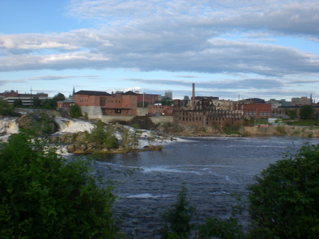
This is the first April in so many years I have not gone down to the Androscoggin Falls to take pictures of the Androscoggin River pouring wildly and furiously over the rocks.
It’s a glorious sight to behold and always a sizeable crowd is assembled, cameras clicking away. Children, dogs and the roaring sound of the water add excitement and wonder at the sound of the water rushing by.
The Mighty Androscoggin, 178 miles long, originates in New Hampshire and twists and turns through Maine on its way, to join the Kennebec River at Merrymeeting Bay before it empties into the Gulf of Maine on the Atlantic Ocean.
The river has meant a lot to us Mainers and we take great pleasure in all it has to offer. It has public boat launches and is a great resource for canoeing, kayaking and fishing. It has biking, walking and hiking with river walks and multi-use trails. But it is just the sight and sound of it that draws some of us.
We are proud of our Auburn River Walk that passes through the heart of the old mill district of the Twin Cities of Auburn and Lewiston. The 1.6 mile paved and gravel path offers many scenic views of the Androscoggin River, the powerhouse that fueled the historic mill industry.
A section of the trail crosses the Androscoggin River on a trestle built by the Grand Trunk Railroad in 1909.
Follow the path and one can read the historical markers and learn the history of Lewiston/Auburn and the river. The segment is paved in bricks and offers benches for viewing wildlife.
Taking the right fork from Bonney Park carries you across the Androscoggin River on a 425-foot converted railroad bridge. Viewing the river, you can appreciate the local efforts to clean up this waterway, once known as the most polluted in the state.
As a young wife, I remember the heavy smell of river — especially on hot summer days — crossing the North Bridge and seeing the white gray foam churning below. I so appreciate having the river walk as a place to bring my grandchildren to enjoy nature and admire the falls as their parents did. We skipped stones and fed the ducks.
After crossing the bridge, you will run into Simard-Payne Memorial Park, which serves as a welcoming gateway to the trail and river. The park has several small walking paths that led down to benches along the river and a paved loop encircling the park. At the top of the loop, a short trail leads to a gravel lot for parking and a picnic area. Much of the description of the Auburn River Walk was taken from Traillink.com.
A footnote to how L/A residents feel about the Androscoggin River is the Logo for USM Lewiston Auburn Senior College. An Ad Hoc Committee was appointed to create a logo for the college. The seven member group met several times during the fall of 2012 brainstorming and came up with a logo making it uniquely Lewiston-Auburn: The Androscoggin River, falling over the rocks connecting (not dividing) Lewiston and Auburn — a landmark that is readily recognized as Lewiston-Auburn. The motto “Forever Learning” depicts the mindset of all Senior College members. Five versions of this Logo were presented to the Board in January 2013 and one version was accepted unanimously.
In the midst of the world-wide pandemic of the Corona Virus, I have adhered to the rule of not going anywhere unless it is of prime importance. It was hard not to go see the Falls in April as I always did. And so, I took solace in reviewing the hundreds of photos I took over the years. I’ve enclosed a few here.
Leave a Reply